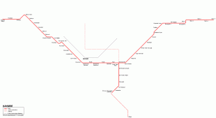
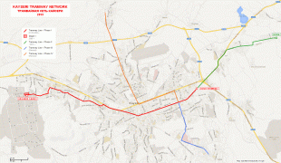
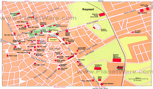
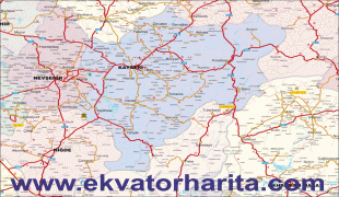
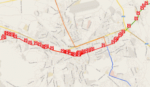
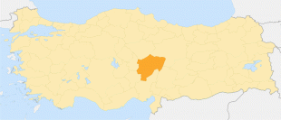
Kayseri
Kayseri (Καισάρεια) is a large industrialised city in Central Anatolia, Turkey, and the capital of Kayseri province. The Kayseri Metropolitan Municipality area is composed of five districts: the two central districts of Kocasinan and Melikgazi, and since 2004, also outlying Hacılar, İncesu and Talas.
As of 31 December 2021, the province had a population of 1,434,357 of whom 1,175,886 live in the four urban districts, excluding İncesu which is not conurbated (i.e. not contiguous, having a largely non-protected buffer zone).
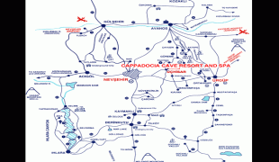
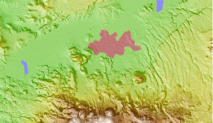
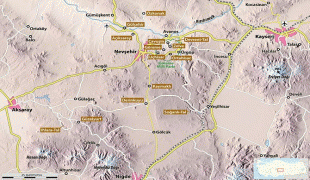
Kayseri sits at the foot of Mount Erciyes (Turkish: Erciyes Dağı), a dormant volcano that reaches an altitude of 3,916 m, more than 1,500 metres above the city's mean altitude. It contains a number of historic monuments, particularly from the Seljuk period. Tourists often pass through Kayseri en route to the attractions of Cappadocia to the west.
Kayseri is served by Erkilet International Airport and is home to Erciyes University.
Kayseri was originally called Mazaka or Mazaca (Մաժաք; according to Armenian tradition, it was founded by and named after Mishak) and was known as such to the geographer Strabo, during whose time it was the capital of the Roman province of Cappadocia, known also as Eusebia at the Argaeus (Εὐσέβεια ἡ πρὸς τῷ Ἀργαίῳ in Greek), after Ariarathes V Eusebes, King of Cappadocia (163–130 BC).
In 14 AD its name was changed by Archelaus (d. 17 AD), the last King of Cappadocia (36 BC–14 AD) and a Roman vassal, to "Caesarea in Cappadocia" (to distinguish it from other cities with the name Caesarea in the Roman Empire) in honour of Caesar Augustus upon his death. This name was rendered as Καισάρεια (Kaisáreia) in Koine Greek, the dialect of the later Byzantine (Eastern Roman) Empire, and it remained in use by the natives (nowadays known as Cappadocian Greeks, due to their spoken language, but then referred to as Rum due to their previous Roman citizenship) until their expulsion from Turkey in 1924. (Note that letter C in classical Latin was pronounced K. When the first Turks arrived in the region in 1080 AD, they adapted this pronunciation, which eventually became Kayseri in Turkish, remaining as such ever since.)
As of 31 December 2021, the province had a population of 1,434,357 of whom 1,175,886 live in the four urban districts, excluding İncesu which is not conurbated (i.e. not contiguous, having a largely non-protected buffer zone).
Kayseri sits at the foot of Mount Erciyes (Turkish: Erciyes Dağı), a dormant volcano that reaches an altitude of 3,916 m, more than 1,500 metres above the city's mean altitude. It contains a number of historic monuments, particularly from the Seljuk period. Tourists often pass through Kayseri en route to the attractions of Cappadocia to the west.
Kayseri is served by Erkilet International Airport and is home to Erciyes University.
Kayseri was originally called Mazaka or Mazaca (Մաժաք; according to Armenian tradition, it was founded by and named after Mishak) and was known as such to the geographer Strabo, during whose time it was the capital of the Roman province of Cappadocia, known also as Eusebia at the Argaeus (Εὐσέβεια ἡ πρὸς τῷ Ἀργαίῳ in Greek), after Ariarathes V Eusebes, King of Cappadocia (163–130 BC).
In 14 AD its name was changed by Archelaus (d. 17 AD), the last King of Cappadocia (36 BC–14 AD) and a Roman vassal, to "Caesarea in Cappadocia" (to distinguish it from other cities with the name Caesarea in the Roman Empire) in honour of Caesar Augustus upon his death. This name was rendered as Καισάρεια (Kaisáreia) in Koine Greek, the dialect of the later Byzantine (Eastern Roman) Empire, and it remained in use by the natives (nowadays known as Cappadocian Greeks, due to their spoken language, but then referred to as Rum due to their previous Roman citizenship) until their expulsion from Turkey in 1924. (Note that letter C in classical Latin was pronounced K. When the first Turks arrived in the region in 1080 AD, they adapted this pronunciation, which eventually became Kayseri in Turkish, remaining as such ever since.)
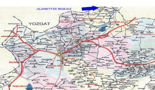
Map - Kayseri
Map


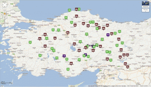
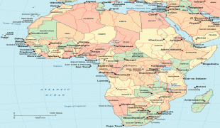
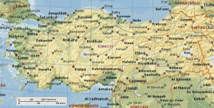
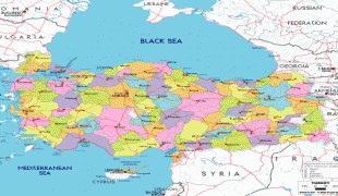
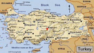
Country - Turkey
 |
|
| Flag of Turkey | |
One of the world's earliest permanently settled regions, present-day Turkey was home to important Neolithic sites like Göbekli Tepe, and was inhabited by ancient civilisations including the Hattians, Hittites, Anatolian peoples, Mycenaean Greeks, Persians and others. Following the conquests of Alexander the Great which started the Hellenistic period, most of the ancient regions in modern Turkey were culturally Hellenised, which continued during the Byzantine era. The Seljuk Turks began migrating in the 11th century, and the Sultanate of Rum ruled Anatolia until the Mongol invasion in 1243, when it disintegrated into small Turkish principalities. Beginning in the late 13th century, the Ottomans united the principalities and conquered the Balkans, and the Turkification of Anatolia increased during the Ottoman period. After Mehmed II conquered Constantinople (Istanbul) in 1453, Ottoman expansion continued under Selim I. During the reign of Suleiman the Magnificent, the Ottoman Empire became a global power. From the late 18th century onwards, the empire's power declined with a gradual loss of territories. Mahmud II started a period of modernisation in the early 19th century. The Young Turk Revolution of 1908 restricted the authority of the Sultan and restored the Ottoman Parliament after a 30-year suspension, ushering the empire into a multi-party period. The 1913 coup d'état put the country under the control of the Three Pashas, who facilitated the Empire's entry into World War I as part of the Central Powers in 1914. During the war, the Ottoman government committed genocides against its Armenian, Greek and Assyrian subjects. After its defeat in the war, the Ottoman Empire was partitioned.
Currency / Language
| ISO | Currency | Symbol | Significant figures |
|---|---|---|---|
| TRY | Turkish lira | ₺ | 2 |
| ISO | Language |
|---|---|
| AV | Avar language |
| AZ | Azerbaijani language |
| KU | Kurdish language |
| TR | Turkish language |